Departemen Teknik Geodesi – Fakultas Teknik UGM
Geodetic Engineering?
The Department Geodetic Engineering (DGE) was established in 1959 and has contributed significantly in educating geospatial professionals in Indonesia and the region. It has produced more than 3000 alumni, positioning the DGE as the biggest education entity in geodetic engineering in Indonesia. Good quality education and a strong network with universities and industries in Asia, Australia, America, Europe and Africa are the main reasons why the International Undergraduate Program of Geodetic Engineering is a convincing choice.
It is a tradition at DGE that collaboration should be done in a transdisciplinary manner. Past and present collaboration with international universities and agencies, including the United Nations, UNDP, UN-HABITAT, IOM, USAID, AuSAID, World Bank, and FIG strengthens international collaboration spirit in delivering research and education outcomes. While engineering and technical aspects are substantial, we view that other disciplines are as equally as essential in providing comprehensive solutions to any problems that require the contribution of geospatial discipline. Hence, collaboration is part of our tradition.
International Undergraduate Program of Geodetic Engineering at UGM
Surveyors and geospatial professionals work in a borderless environment. They work with professionals from different countries and also from different disciplines. They work in a multidisciplinary manner to provide comprehensive solution to problems faced by the society. Consequently, sophisticated hard skill is not the only competence they need. They also need interpersonal skills and ability to work in an international environment. Be it in a small village in Indonesia or in a big city in Europe, America, Africa, or Australia. International interaction is now inevitable.
To prepare young surveyors and geospatial professionals to be able to contribute in an international working environment, we need an education program with adequate international exposures. We need a program that gives students opportunities to interact with international academic and professionals. We introduce to you, an International Undergraduate Program (IUP) of Geodetic Engineering at Universitas Gadjah Mada.
Competences, Learning and Expertise
The program envisages alumni with the following competencies:
Be able to apply fundamental mathematical, scientific, and engineering principles in formulation and solving engineering problems, as well as to excel in a career utilizing their education in geodetic areas of practices.
Be able to develop and expand their knowledge of geodetic engineering fields, as well as other relevant fields through further professional licensure of graduate studies in engineering or sciences.
Be able to work effectively in multidisciplinary and diverse professional environments as well as to provide leadership and demonstrate professional integrity.
To achieve the above competencies, a comprehensive and strong curriculum has been developed. It consists of 145 credits (128 compulsory + 17 elective), expected to be completed in eight semesters. Please refer to the detailed curriculum for comprehensive understanding.
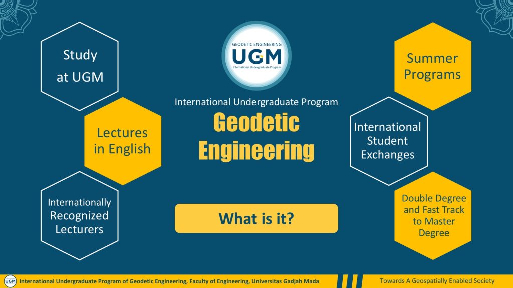
Here are five main areas of expertise we expect the student to excel upon completing the program:
Surveys & Mapping
Concept and practical aspects regarding the production of maps, especially on how to gather data from real the world using proper equipment and technology.Photogrammetry & Remote Sensing
The use of aerial photo and satellite images for mapping objects on Earth. The application of popular technology such as drones and LiDAR is extensively explored here.Hydrography
Mapping for the ocean to understand the characteristics of seafloor, potential resources of the ocean and legal/administrative aspect such as marine cadastre and maritime boundaries between countries.Geometrical Geodesy & Physical Geodesy
Understanding the shape and dimension of the Earth using scientific approach and its relation to Earth dynamics. We will understand Earth phenomena such as land slide, earthquake, and other disaster better.Geoinformatics and Geospatial Information Infrastructure
The management of Earth information using advanced approach and technology. This includes geographic information system with the use of rapidly growing information and communication technology. Artificial intelligence, big data, machine learning, deep learning, and others are explored here.
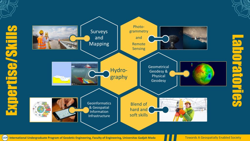
International Exposures
Each student is required to undergo international exposures as part of the degree program. They can opt for, but not limited to, conferences/seminars, short courses (summer/winter program), semester-based exchange/mobility, and double degree. Here is list of partners where students can do their international exposures:
University of Melbourne [UoM], Australia (A program has been developed with the University of Melbourne (UoM) to complete one semester of the UGM Bachelor Program which will lead to fast-track (1.5 years) Master of Digital Infrastructure Engineering at the UoM. This is a collaborative fast-track Master of Engineering pathway model between two institutions)
ITC, Twente University, Netherlands (Semester-based Mobility)
Technical University of Munich (TUM), Germany (Semester-based Mobility)
Universiti Teknologi Malaysia (Semester-based Mobility)
Fees
Each student is required to pay a semester-based tuition fee of IDR 30,000,000.00 (approximately USD 2,010). No settlement fee is required, meaning that students will not be required to pay establishment fee at the beginning of the study other than the regular tuition fee.
Please take note that this tuition fee excludes all the cost of the international exposures, which will be borne by students. However, scholarship and other financial assistance may be available from various sources.
Future and Prospects
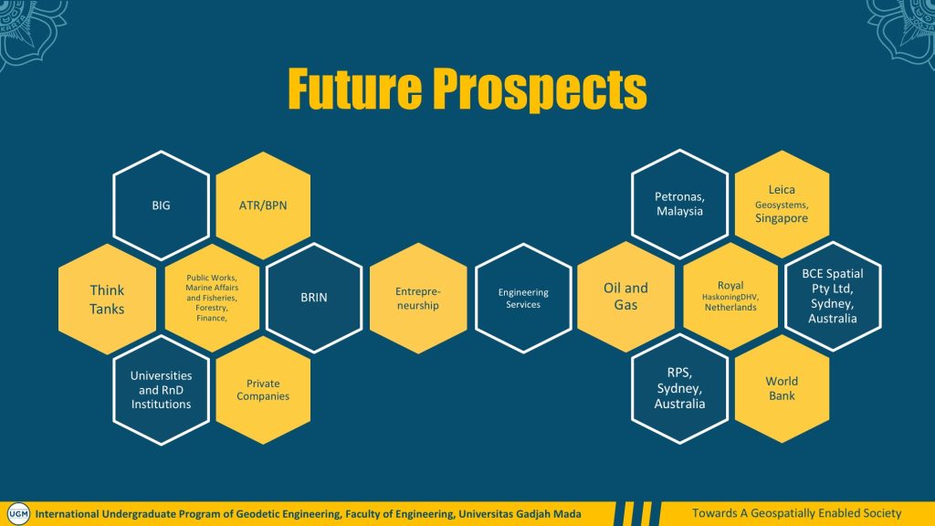
Alumni of the international program at DGE are prepared to take part in the international job market. The jobs are not necessarily located outside of Indonesia but those requiring interaction with the international community. Here are same options where our alumni can go and start their career:
National Agencies and Ministers
Geospatial Information Agency (BIG)
Ministry of Agrarian Affairs and Spatial Planning / National Land Agency (ATR/BPN)
Ministry of Public Works and Housing (PUPR)
Ministry of Environment and Forestry (LHK)
Ministry of Finance (Kemenkeu)
Ministry of Transportation (Perhubungan)
Ministry of Home Affairs (Kemendagri)
Ministry of Marine Affairs and Fisheries (KKP)
Indonesian Armed Force (TNI)
National Research and Innovation Agency (BRIN)
Industries
Engineering Services
Oil & Gas
Transportation
Natural Resources Management
Private Survey & Registered Land Surveyor
Gojek
Tiket.com
International Agencies
Petronas, Malaysia
Leica Geosystems, Singapore
Royal HaskoningDHV, Netherlands
RPS, Sydney, Australia
BCE Spatial Pty Ltd, Sydney, Australia
World Bank
Future Possibilities
In addition to their readiness in entering the global job market, graduates of the International Undergraduate Program of Geodetic Engineering are also prepared for further education. Pursuing a master’s degree is something that graduates can opt for. Scholarships are available from different sources including LPDP Scholarship by the Government of Indonesia. A program has been developed with the University of Melbourne (UoM) to complete one semester of the UGM Bachelor Program which will lead to fast-track (1.5 years) Master of Digital Infrastructure Engineering at the UoM. This is a collaborative fast-track Master of Engineering pathway model between two institutions, which graduates can also apply for.
How to apply
It is worth noting that only highly qualified candidates will be admitted in the International Undergraduate Program of Geodetic Engineering. Candidates should be academically qualified, confirmed by their score of UTBK-SNBT or UM-CBT UGM. This is also to confirm that only candidates who will take (or have taken) UTBK-SNBT or UM-CBT UGM are qualified for the program. In addition, candidates must possess adequate English proficiency. Here are essential documents for applications:
Scanned Valid ID Card (e.g. KTP, Passport)
Curriculum Vitae (please use this template)
Motivation Letter (no template available, use your own imagination)
Scanned scores of SNBT UTBK, or SAT (Scholastic Assessment Test). For international students, high school institutions must have equivalent qualifications to A-Level or International Baccalaureate or be endorsed by the Indonesian Embassy in the country of origin. The transcripts must be in English. For additional description, please refer to https://iup.ft.ugm.ac.id/en/selection-process-and-admission-requirements/
English Certificate (PBT TOEFL of 500 or above, iBT TOEFL of 61 or above, IELTS of 6 or above, ACEPT of 268 or above, DUOLINGO of 110 or above)
Letter of Financial Commitment (please use this template)
High School Certificate (Ijazah SMA, no translation needed for document in bahasa Indonesia)
Academic Report (Nilai Rapor SMA, no translation needed for document in bahasa Indonesia)
Proof of Achievements (if any, certificates, awards, etc., no translation needed for document in bahasa Indonesia)
Statement of Document Authenticity-IUP (please use this template)
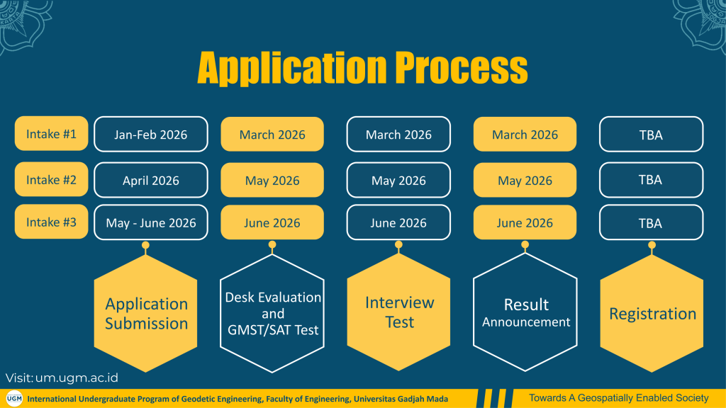
Application must be made through um.ugm.ac.id by creating and account and providing us with all the required documents. The documents will be assessed thoroughly for the stage 1 selection process. Only shortlisted candidates will be invited for an interview for final decision. Here is the admission schedule:
Intake #1
- Application Submission (20 January – 19 February 2026)
- Desk Evaluation and GMST/SAT (5 – 7 March 2026)
- Interview Test (5 – 7 March 2026)
- Result Announcement (12 March 2026)
- Registration (TBA)
Intake #2
- Application Submission (1 – 28 April 2026)
- Desk Evaluation and GMST/SAT (7 – 9 May 2026)
- Interview Test (7 – 9 May 2026)
- Result Announcement (13 May 2026)
- Registration (TBA)
Intake #3
- Application Submission (19 May – 2 June 2026)
- Desk Evaluation and GMST/SAT (11 – 13 June 2026)
- Interview Test (11 – 13 June 2026)
- Result Announcement (18 June 2026)
- Registration (TBA)
Contact
Head of study program of Geodetic Engineering, UGM
Dr. Heri Sutanta
Email : geodesi@ugm.ac.id
WA : +62 858 6722 3355