Imagine the world around you. The use of GPS is now everywhere. We can see people capturing objects using drone, laser scanners, and Light Detecting and Ranging (LiDAR). We depend on online maps to navigate our journey. We also use satellite images to find locations. To save our lives, we have experts mitigating disasters utilizing surveys and mapping technology.
Using appropriate approach and technology, officials ensure the proper administration of land. Meanwhile, engineers conduct surveys to map the earth’s surfaces for civil works and oil & gas exploration. Similar technology is also used by professionals to monitor 3D construction.
Furthermore, you cannot live without online shopping & food delivery.
Who are behind all of these?Geodetic Engineers!They are geospatial professionals.
We also witness the explosion of big data from mobile phones, self-driving cars, and Internet of Things (IoT) sensors. Let it be known that 80% of the data are geospatial in nature. This makes the role of geospatial professionals even more exciting.
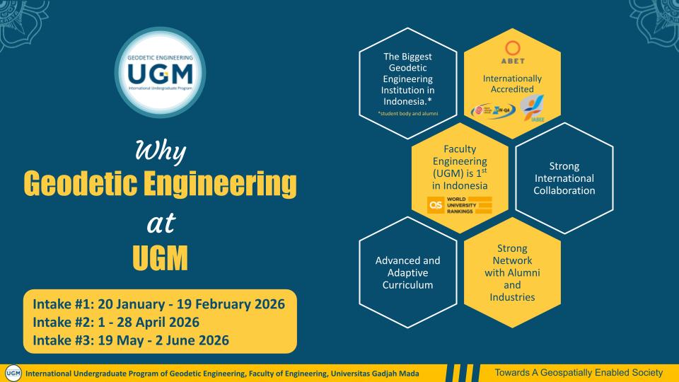
Should you want to be part of the exciting role and journey, the International Program of Geodetic Engineering at Universitas Gadjah Mada is the one for you. A place where international experiential learning is prepared for endless future opportunities. Start your geospatial endeavor here!