Departemen Teknik Geodesi – Fakultas Teknik UGM
Why "Where" Matters: Living in A Globalizing World
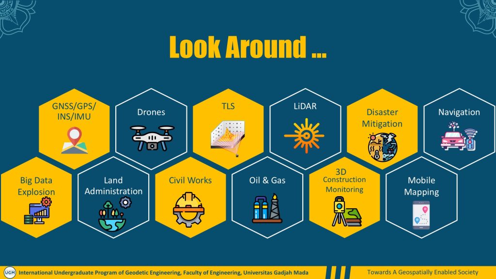
Geodetic Engineering is the science and art of location. A specific term commonly used is “geospatial” which refers to objects, events or other features with a location on or near the surface of the Earth. While you might not have heard much about it, it is in fact the one behind a lot of applications such as global navigation satellite system (e.g. GPS), surveys and mapping (e.g. Terrestrial Laser Scanning – TLS, Light Detection and Ranging – LiDAR, Unmanned Aerial Vehicles – UAV) , online and smart maps, satellite images, disaster mitigation and risk reduction, land administration, engineering survey for civil works, oil & gas sectors, 3D construction monitoring, online shopping & food delivery; you name it! All of the applications deal with location; Hence, why “where “ matters.
It is also worth noting that we witness the explosion of (big) data, 80% of which are geospatial in nature (e.g., data from mobile phones, self-driving cars, IoT sensors, etc). Meanwhile, most of the methodologies, algorithms and technologies currently used by geospatial professionals are incapable of dealing with such large datasets. Therefore, it is an exciting opportunity to work on these frontiers to gain insight and support decision making tools in ways that were not previously possible.
Should you want to take part in the above new applications and state-of-the-art development, studying geodetic engineering at UGM is an option worth considering. The program also encompasses Geomatics Engineering, which entails all the business-process of geospatial data activities, i.e., precise geospatial data collections, processing and analysis as well as data presentation and visualization.
While mapping the Earth’s surface is probably the most common application of geodetic engineering, countless unconventional and unprecedented possibilities are waiting in the future. The emergence of artificial intelligence, for example, will revolutionize the way we deal with Earth’s data and information. Eventually this will also bring possibilities in the development of geodetic engineering. You should be part of the exciting future.
In a globalizing world, the need for us to understand the Earth has never been timelier. This will also bring us more opportunities to work with different people regardless of their nationalities. You will work to map the changing world with people from different countries. In a borderless world, you might work in a small city in Indonesia but your working environment will be global. Hence, understanding and practicing international work ethics is compulsory. That is why an international education degree is a promising choice.
We welcome you to the International Undergraduate Program of Geodetic Engineering at Universitas Gadjah Mada!