Yogyakarta, 27 Juli 2026 – Dosen Departemen Teknik Geodesi Fakultas Teknik Universitas Gadjah Mada (FT UGM), Febrian Fitryanik Susanta, mempresentasikan penelitian pada XXV International Society for Photogrammetry and Remote Sensing (ISPRS) Congress 2026 yang diselenggarakan pada 4–11 Juli 2026 di Metro Toronto Convention Centre, Toronto, Kanada. Febrian saat ini juga sedang menempuh pendidikan doktoral di Department of Geomatics, National Cheng Kung University (NCKU), Taiwan.
ISPRS Congress merupakan agenda ilmiah utama yang diselenggarakan setiap empat tahun oleh International Society for Photogrammetry and Remote Sensing. Didirikan pada 1910, ISPRS merupakan organisasi internasional tertua yang menaungi bidang fotogrametri, penginderaan jauh, dan ilmu informasi spasial. Kongres ini mempertemukan komunitas akademik, lembaga pemerintah, organisasi profesi, serta industri geospasial dari berbagai negara.

Penyelenggaraan ISPRS Congress 2026 menghadirkan rangkaian sesi pleno, presentasi ilmiah, sesi poster, tutorial, forum tematik, pameran teknologi, serta kegiatan jejaring internasional. Kongres ini mencakup 1.327 presentasi, yang terdiri atas 775 presentasi oral dan 552 presentasi poster. Presentasi oral tersebut diselenggarakan dalam 137 sesi yang mencakup lima komisi teknis ISPRS, sesi tematik, sesi khusus, Canadian Symposium on Remote Sensing, dan sesi aplikasi.

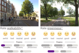
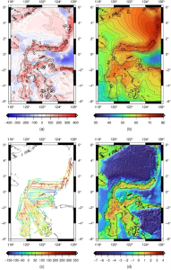
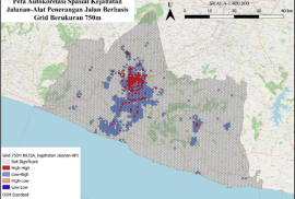
Dalam kongres tersebut, Febrian mempresentasikan penelitian berjudul Modeling Dynamic Walkability to Support Time-Based Route Planning for Older Adults pada sesi WG IV/10: Applied Spatial Science for Public Health. Penelitian tersebut disusun bersama Associate Professor Pei-Fen Kuo dan I Gede Brawiswa Putra serta diterima untuk dipublikasikan dalam The International Archives of the Photogrammetry, Remote Sensing and Spatial Information Sciences (https://www.isprs2026toronto.com/proceedings-schedule). Kegiatan penelitian Febrian di NCKU dilaksanakan melalui Spatial Social Sciences Laboratory, Department of Geomatics, di bawah bimbingan Associate Professor Pei-Fen Kuo.

Partisipasi Febrian dalam ISPRS Congress 2026 memperoleh dukungan dari Prof. Fuh-Gwo Yuan Endowed Scholarship, College of Engineering, National Cheng Kung University, serta National Science and Technology Council (NSTC) Funding Program for Graduate Students Attending International Conferences, Taiwan, melalui nomor grant NSTC-115-2922-I-006-075. Dukungan pendanaan tersebut memberikan kesempatan bagi Febrian untuk mempresentasikan hasil penelitian, mengikuti perkembangan terbaru di bidang geospasial, serta berdiskusi langsung dengan peneliti dan praktisi internasional. Sesi ilmiah, pameran teknologi, dan kegiatan jejaring juga memperluas peluang kolaborasi serta memperkuat kapasitas penelitian dalam bidang GIS, mobilitas perkotaan, dan analisis spasial.

Keikutsertaan ini mencerminkan peran aktif sivitas akademika Departemen Teknik Geodesi FT UGM dalam forum ilmiah internasional. Partisipasi pada kongres berskala global seperti ISPRS Congress juga menjadi bagian penting dalam penguatan jejaring institusi, peningkatan kualitas penelitian, serta pengembangan kolaborasi antara UGM, NCKU, dan komunitas geospasial dunia.