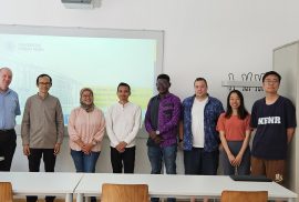
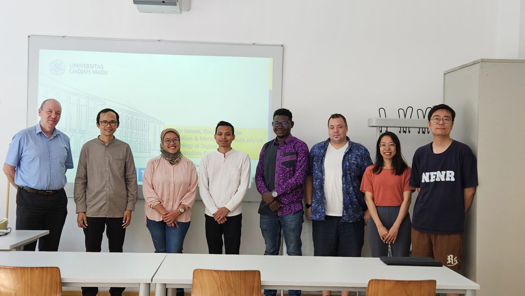
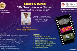
The Department of Geodetic Engineering , Gadjah Mada University in collaboration with the Department of Geomatics, National Cheng Kung University Taiwan will hold a short course on the use of UAV photogrammetry for 3D modeling. Professor Jiann Yeou Rau will provide material for 12 days from January 27 to February 7, 2020 in the Meeting Room I of the UGM Geodetic Engineering Department Building.

Gunung Agung is one of the most active volcanoes in Indonesia located in Karangasem regency, Bali. Mount Agung had an increased activity and on September 18, 2017 the Center for Volcanology and Geological Hazard Mitigation (PVMBG) officially raised the status of the alert into alert, as well as on 22 September 2017 rose again to alert. Residents and pets have been evacuated to spread to several evacuations. However on October 29, 2017 PVMBG officially downgraded its status from alert to alert.
Refugees living in evacuation with makeshift facilities, automatically will appear some diseases that attack the refugees. The government, especially the Dinas Kesehatan, also contributed to the handling of these issues, ranging from the health of the IDPs who must be maintained, the trauma healing after the disaster, and many refugees belonging to the vulnerable categories of elderly, pregnant women and toddlers.
As the status of Mount Agung rose, a team from UGM Geodesy Engineering in cooperation with UGM Disaster Response Unit (DERU) and Regional Disaster Management Agency (BPBD) successfully mapping the area around the slopes of Mount Agung using the Buffalo FX-79 drill facility. Visualization gained is very helpful to see the current state of Mount Agung.
Webinar series of November period is the theme of handling situation of Gunung Agung. Discussion and sharing experiences about programs and actions that have been undertaken by the local Dinas Kesehatan in handling the disaster. Besides sharing the experience of the Geodesy Engineering team about the process and finally managed to get the visualization of Mount Agung.
Link for webinar registration: http://www.bencana-kesehatan.net/index.php/65-agenda/2852-webinar-series-situasi-penanganan-aktivitas-gunung-agung
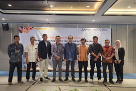
On September 26, 2017, a public lecture and ERDAS software grant from Leica Geosystems Indonesia to the UGM Geodetic Engineering Department was held. A total of 500 software licenses consisting of three leading products of ERDAS, Geomedia Desktop 2016, ERDAS Foundation 2016 and ERDAS IMAGINE 2016 are distributed free of charge to UGM Geodetic Engineering Department students interested in using GIS, Photogrammetry and Remote Sensing software.
Along with the symbolic software license submission, a public lecture by Bpk. Badruszaman and Bpk. Arvy Fachrully as representative of Leica Geosystems Indonesia. In his general lecture, Mr. Badruszaman explained about the progress of survey and mapping technology in Indonesia, especially on airborne mapping for photogrammetry, LiDAR and hydrography. Students who attend seem interested in following the explanation delivered, as evidenced by the many questions asked to the presenters about the presentation submitted. The public lecture and licensing ceremony was then ended by doorprice-sharing from Leica Geosystems to some of the lucky students.
At the 30th National Student Scientific Competition (PIMNAS) competition organized by Kemenristekdikti at Universitas Muslim Indonesia Makassar on 23rd to 28th of August 2017, one of the team from Universitas Gadjah Mada won the 1st Winner of PKM Entrepreneurship. The team consists of Ali Surojaya (Engineering Geodesi 2016) as chairman, and comprises Muhammad Fahriza (Engineering Physics 2016), Marisha Salsabila (Computer Science 2016), Muhammad Nizar Rahman (Computer Science 2016), and Maulidini Fatimah Azahra (Remote Sensing and GIS 2016). With the guidance of Dr.Eng Herianto, S.T, M.Eng.
Raising the theme of educational media to raise awareness of technological innovation for children in Indonesia with Title Eldu Kit. The team was selected to be one of the 3,918 proposals funded from 77,678 proposed PKM proposal titles. The implementation of the Student Creativity Program (PKM) activity is quite long, after passing funded, each team must conduct Monitoring and Evaluation activities. Only then was elected 420 PKM title that pass to compete in this 30th PIMNAS event.
In this PIMNAS there are two main activities namely Poster Scientific and Presentation Exhibition, with each will be contested champion in each category. Of the total 23 medals achieved by UGM, Team Eldu Kit successfully contributed 1 Gold Medal in Presentation category. Gadjah Mada University won the title with details of 3 Gold Medals, 2 Silver Medals, and 2 Bronze Medals in the Presentation category. And 5 Gold Medals, 5 Silver Medals, and 6 Bronze Medals in the Poster category. In addition UGM also won 10 Favorite Awards.
Leica Geosystems Indonesia in cooperation with UGM Geodesy Engineering Department provides 500 free ERDAS software licenses for use by students. Here are the free shared software:
1. GeoMedia Desktop 2016
2. ERDAS Foundation 2016
3. ERDAS IMAGINE 2016 (64 bit or 32 bit)
All three software can be used by students who are interested to explore the field of GIS, photogrammetry and remote sensing using ERDAS software. Technical installation and licensing implementation can contact Dany Laksono at Lt.1 Building Geodesy Engineering UGM.
The Hydrographic and Oceanographic Center of Indonesian Navy (Pushidrosal) from September 11-15, 2017 hosted a Five Day Training in Hydrographic Survey for Disaster Management and Relief at Mercure Hotel, Ancol, North Jakarta, Monday (11/9) .
The training, which focuses on the role of hydrographic surveys in natural disaster management and response, was attended by 25 participants from 12 East Asia Hydrographic Commission (EAHC) member countries, namely Malaysia, Singapore, Thailand, Brunei Darussalam, Philippines, Timor Leste, Papua New Guinea, Vietnam, Japan, China, South Korea and Indonesia as the host.
Kapushidrosal Rear Admiral TNI Harjo Susmoro in his speech at the opening of the training, among others said that this training is one of the EAHC program, where Indonesia is one of its members. As a member of the Hydrographic Community and Mapping, Indonesia should seek to improve its capacity and capacity in the countries of East Asia and the South Pacific region.
These training activities aim to improve hydrography, from gathering, processing, and analyzing data that can be used to manage and minimize casualties from natural disasters as well as to establish alternative routes for navigational safety for ships sailing around the disaster area, as well as up dating of hydrographic data which is very important for the success of humanitarian relief disaster relief mission.
Also present, Deputy I of Kemenkomar. Arief Havas Oegroseno who conveys the government policy perspective on disaster management and the importance of hydrographic mapping support in disaster mitigation and disaster relief support. Furthermore, BNPB Laksda TNI (Ret.) Willem Rampangilei also conveyed the role and duties of BNPB in the effort of disaster prevention and handling and disaster mitigation. He also said that disaster management requires synergy between government institutions, especially Pushidrosal in disaster prevention and post disaster efforts and emergency response efforts in mapping disaster-affected areas and mapping of access areas and disaster areas.
For five days, all participants will receive training from hydrographic experts from Japan and Indonesia, such as Abdul Basith, PhD from UGM, Gegar Sapta Prasetya, Bsc, MSc, PhD from Tsunami Research Foundation Indonesia, Dr. Rer.nat. Poerbandono from ITB, Prof. Ir. Radianta Triatmaja, PhD from UGM, Colonel Laut (E) Yanuar Handwiono, SH, M.Tr (Han) and two Japanese experts Dr. Takashi Tomita and Dr. Yoshihiro Matsumoto.
The focal point of the training is in the form of the delivery of materials and knowledge, the exchange of experience of hydrographic aspects of the participants and experts in overcoming and overcoming natural disasters, which are broadly divided into two, namely national missions, policies and programs related to natural disaster management in Indonesia and technical and social aspects of natural disaster management and management that include recovery, risk identification, disaster prevention and handling and preparedness.
The subject matter that is delivered among others; Overview: Role of Hydrographic Office againts Maritime Disaster, Tsunami Information Map, Tsunami Manner in the Building and Cultural Awareness for the Coastal Society, Volcanic Tsunami and Submarine Landslide, and Tsunami in Indonesia: Mechanism, Characteristics, and Damage Assessment.
Quoted from source: http://www.tnial.mil.id/News/Seremonial/tabid/79/articleType/ArticleView/articleId/39356/Default.aspx
 Mid-year 2017, the Department of Geodesy Engineering graduated more than 50 final year students as a Bachelor of Engineering (ST). Of these, as many as 42 students are students who complete their studies on time (4 semesters). This period also recorded the graduation record of Geodetic Engineering with the highest graduates with the highest average GPA and the acquisition of Cum Laude degree, which is 20 people.
Info Day is an activity intended for new students of Geodetic Engineering Study Program, Engineering faculty, UGM. This event was a forum to provide various information about Geodetic Engineering Study Program such as academic activities, socialization, lecturer introduction, campus facilities and etc. Info day was attended by 103 new students, lecturers, and members of KMTG 2017. KMTG is a student organization in Department of Geodetic Engineering. Head of Geodetic Engineering Department, Mr. Ir. Prijono Nugroho D, MSP., Ph.D, started this event and gave a speech. Then, the event continued with socialization in the classroom. Not only socialization in the classroom, but new students are invited to tour the campus and know the location of campus facilities such as laboratory, classroom, teaching room, mosque,secretariat room of KMTG, and BSO. This Tour is guided by KMTG members. At the end of the event, Mr. Harintaka, ST., MT. as the Head of Geodetic Engineering Study Program, provided advice and gave spirit for new students in Geodetic Engineering Study Program.